

 Smoky haze
 Light rain shower
 Mist
This post may contain affiliate links. If you purchase through them, I may earn a small commission at no extra cost to you. Thanks for supporting our small business.
Munnar is a hill station at 1,532m (5,026 ft) in Kerala’s Idukki district, built around the tea estates that Kannan Devan Hills Plantations has run since the 1870s. Temperatures average 18.5°C year-round, rainfall totals 2,672mm, and the town is the main base for Eravikulam National Park, the Nilgiri tahr, and the tea-covered slopes of the Western Ghats. This guide covers the weather, the best months to visit, and where to stay.
Welcome to Munnar
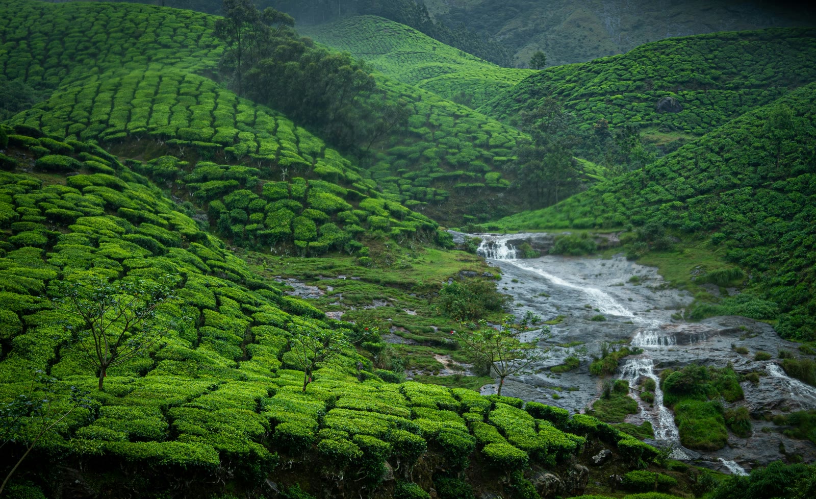
Munnar grew out of a British-era tea town, and the plantations still define it: the hills around town are striped with tea bushes, the museum in the old factory tells the industry’s story, and the cool, misty air is why people drive up from the coast. Most visitors spend two or three days here, using the town as a base for dam-side viewpoints, waterfall stops, and a national park.
The name comes from the Tamil words for three rivers, and the town sits where the Muthirapuzha, Nallathanni, and Kundala rivers meet. Its elevation means the weather does not match the rest of Kerala: it stays 5 to 8°C cooler than Kochi, and the monsoon is heavier here because the Western Ghats catch the full force of the southwest rain.
Munnar Weather at a Glance
Munnar’s elevation keeps it cool. The average high ranges from 21°C in July to 26°C in March, and nights drop to 13 to 17°C year-round, so the town averages 18.5°C overall, about 6°C cooler than Kochi on the coast. Even in April, the warmest month on the plains, Munnar rarely passes 26°C.
Rainfall is heavily seasonal. The southwest monsoon from June to September delivers more than half the year’s 2,672mm, with June alone at 434mm, while December to February is the dry season with just 31mm a month. October and November bring a second, lighter burst from the northeast monsoon.
For the full month-by-month numbers, see the Munnar weather by month page, which includes a temperature and rainfall table.
Munnar Seasons at a Glance
- Winter (December to February): highs of 22 to 25°C, about 31mm of rain a month, clearest skies, and the busiest, priciest period.
- Summer (March to May): highs up to 26°C with pre-monsoon thunderstorms, 165 to 256mm of rain, and swelling waterfalls.
- Monsoon (June to September): highs near 21°C, 400mm+ of rain a month, possible landslides, and the lowest hotel rates.
- Post-monsoon (October to November): highs of 22°C, 277 to 338mm of rain, clear spells between showers, and good value.
Plan Your Trip to Munnar
Each of these guides covers one part of planning a Munnar trip in detail:
- Munnar Weather by Month: monthly temperatures, rainfall, humidity, and sunshine, with a full data table.
- Best Time to Visit Munnar: when to go for weather, prices, and crowds, month by month.
- Things to Do in Munnar: tea gardens, dams, waterfalls, and wildlife, with entry fees and hours.
- Munnar Events and Festivals: Onam, Pongal, Vishu, and the Neelakurinji bloom, with dates.
- Munnar Neighborhoods: Munnar town, Pothamedu, Chithirapuram, Chinnakanal, Devikulam, and Marayoor.
- Where to Stay in Munnar: the best areas and specific hotels for every budget.
- Munnar Travel Tips and FAQ: airports, taxis, costs, visas, safety, and packing.
Munnar Quick Facts
- Elevation: 1,532m (5,026 ft).
- Average temperature: 18.5°C (65°F).
- Annual rainfall: 2,672mm.
- Nearest airport: Cochin International Airport (COK), 110km away.
- Nearest railway station: Aluva, 110km away.
- Best time to visit: September to March.
- Highest nearby peak: Anamudi, 2,695m, the highest in South India.
Where to Stay in Munnar
Munnar splits its beds between the convenience of Munnar town and the tea-estate views of the surrounding hills. Budget and mid-range hotels cluster in town near the bus stand, five-star resorts sit on the ridges at Pothamedu, and family resorts fill Chithirapuram and Chinnakanal. Rates run from ₹1,200 homestays to ₹20,000 suites, and they spike in December and fall by half in the June-to-August monsoon.
For a district-by-district breakdown with specific hotel names, read the where to stay in Munnar guide.
Suggested Hotels in Munnar
Fragrant Nature Munnar
A five-star classified hotel with an infinity pool, spa, fitness center, and free English breakfast, set on the hills of Pothamedu. Best for couples and families who want full resort facilities and misty mountain views. Check rates and availability
Parakkat Nature Resort
A resort with free WiFi, mountain views, and a barbecue, set in a quiet part of Munnar. Best for couples who want a nature-focused mid-range stay with big views. Check rates and availability
Nature Zone Jungle Resort
An authentic tree-house resort at about 1,800m with an on-site restaurant and 24-hour front desk, near Pullipara. Best for couples and solo travelers who want a memorable tree-house stay on a moderate budget. Check rates and availability
Location and Climate Context
Munnar sits in the Western Ghats of Kerala’s Idukki district, about 110km east of Kochi and close to the Tamil Nadu border. Its climate comes from two things: the 1,500m+ elevation, which keeps temperatures mild, and the southwest monsoon that hits the Ghats directly and drops most of the year’s rain between June and September. The result is a cool, green hill station that stays comfortable even when the Kerala coast is sweltering.
The town is reached entirely by road, usually from Kochi or Coimbatore, since the nearest airport and railway station are both in the plains over 100km away. That road access, plus the tea economy, shapes when and how people visit, which the Munnar travel tips page covers in detail.
